- AUSTRALIA: NEW SOUTH WALES
- AUSTRALIA: QUEENSLAND
- AUSTRALIA: TASMANIA
- Evercreech Forest Reserve
- Franklin-Gordon Wild Rivers National Park
- Lower Coles Road
- McDougall’s Road
- Reynold Falls Nature Recreation Area
- Styx Tall Trees Forest Reserve
- Tarkine
- AUSTRALIA: VICTORIA
- AUSTRIA
- BOSNIA-HERZEGOVINA
- BULGARIA
- Baiuvi dupki-Dzhindzhiritsa Nature ReserveNEW
- Boatin Strict Nature Reserve - NEW !!
- Dzhendema Strict Nature Reserve - NEW !!
- Parangalitsa Strict Nature Reserve - NEW !!
- Rila Monastery Forest Reserve - NEW !!
- Steneto Strict Nature Reserve - NEW !!
- CANADA: ALBERTA
- CANADA: BRITISH COLUMBIA
- Carmanah Walbran Provincial Park
- Clayoquot Sound Biosphere Reserve
- Glacier National Park
- MacMillan Provincial Park
- Pacific Rim National Park Reserve
- Yoho National Park
- CANADA: NOVA SCOTIA
- CANADA: ONTARIO
- Lake Superior Provincial Park
- Michipicoten parks
- Quetico Provincial Park
- Rainbow Falls Provincial Park
- CANADA: SASKATCHEWAN
- CROATIA
- CZECHIA
- DENMARK
- FINLAND
- Helvetinjärvi National Park
- Isojärvi National Park
- Kurjenrahka National Park
- Patvinsuo National Park
- Petkeljärvi National Park
- Pyhä-Häkki National Park
- Urho Kekkonen National Park
- Vätsäri Wilderness Area
- GEORGIA
- GERMANY
- Bavarian Forest National Park
- Fauler Ort Nature Reserve
- Hainich National Park
- Harz National Park
- Heilige Hallen Nature Reserve
- Jasmund National Park
- Müritz National Park
- Rhön Biosphere Reserve
- IRAN
- JAPAN
- MALAYSIA
- Taman Negara - NEW !!
- MONTENEGRO
- PORTUGAL
- ROMANIA
- SLOVAKIA
- Boky National Nature Reserve
- Dobroč National Nature Reserve
- Havešová National Nature Reserve
- Stužica National Nature Reserve
- SPAIN
- SWEDEN
- UNITED STATES: CALIFORNIA
- Humboldt Redwoods State Park
- Kings Canyon National Park
- Mokelumne Wilderness
- Prairie Creek Redwoods State Park
- Sequoia National Park
- Yosemite National Park
- UNITED STATES: MICHIGAN
- UNITED STATES: WASHINGTON
- Goat Marsh Research Natural Area
- Mount Rainier National Park
- Olympic National Forest
- Olympic National Park
- UNITED STATES: WYOMING

Mtirala National Park , Georgia
There was a strict nature reserve inside the park area until 1961 when the reserve was unfortunately abolished 1 . The national park (158 km 2 ) was established only in 2007. It adjoins Kintrishi Strict Nature Reserve (139 km 2 ).
Annual precipitation exceeds 2500 mm, even reaching 4000 mm
2
on some uppermost slopes; thus, this is the wettest place in the Caucasus and also in the whole former Soviet Union
1
. Average annual temperature is 9–10°C at the park’s higher elevations discussed below
2
. The forests have often been called temperate rainforests. Compared with the temperate rainforests of the Pacific Coast of North America (see
 Olympic National Park
) and the Southern Hemisphere (see
Tarkine
), the climate is somewhat more continental. The summer dry season, an important characteristic of the Pacific Coast of North America, is absent
3
. As a consequence of these climatic differences, the forest consists of deciduous broadleaf trees. The forests of northern Iran (see
Alborz Mountains
)
and western Georgia have a number of common features
3
.
Olympic National Park
) and the Southern Hemisphere (see
Tarkine
), the climate is somewhat more continental. The summer dry season, an important characteristic of the Pacific Coast of North America, is absent
3
. As a consequence of these climatic differences, the forest consists of deciduous broadleaf trees. The forests of northern Iran (see
Alborz Mountains
)
and western Georgia have a number of common features
3
.
Elevation ranges from approx
.
200 m
to 1764 m. The slopes are steep. As in northern Iran, there was a glacial refugium in the lowlands of western Georgia and adjacent areas
3
, consequently many regional endemics can be found on the park’s lower slopes. However, the low-elevation forests are not in their natural state. At higher elevations individual trees have been felled before the park’s establishment
4
but the forest nevertheless looks quite undisturbed with large and dead trees; however, here the diversity is rather low. For information about tree identification, see
Borjomi Strict Nature Reserve
.
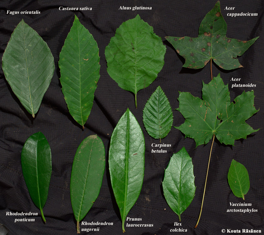
Fagus orientalis
(oriental beech) dominates. The other abundant trees are
Castanea sativa
(sweet chestnut),
Carpinus betulus
(European hornbeam) and
Alnus glutinosa
subsp.
barbata
(black alder)
2
. Here
A. glutinosa
is not restricted to riversides and wetlands but also grows on slopes and ridges.
C. sativa
was formerly widespread in Georgia’s forests but today it can only be found in mountains with limited accessibility
5
.
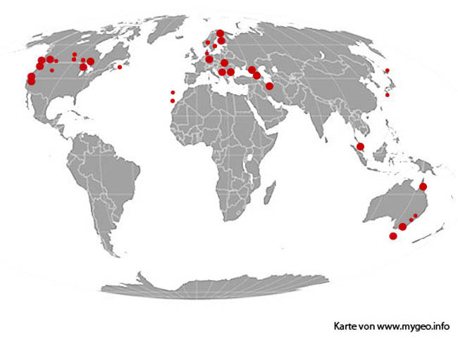
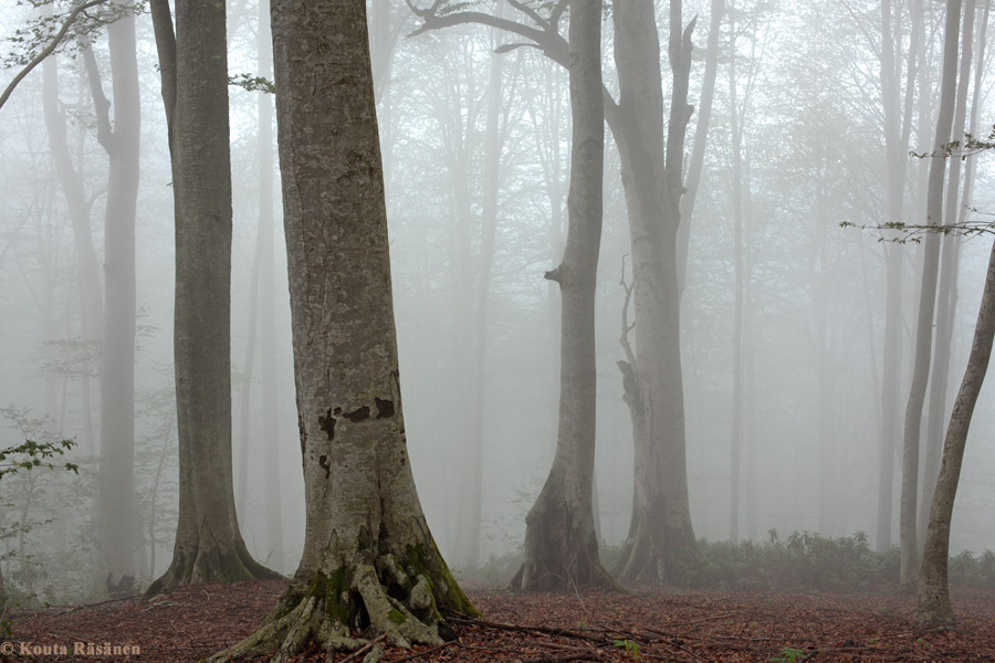
A remarkable difference to Europe’s
Fagus sylvatica
(European beech) forests (see
Heilige Hallen Nature Reserve
) is the undergrowth, which typically consists of a dense, mostly evergreen, vegetatively regenerating shrub layer. The most abundant species is
Rhododendron ponticum
(pontic rhododendron), other common species being
Rhododendron ungernii
,
Prunus laurocerasus
(cherry laurel),
Ilex colchica
and
Vaccinium arctostaphylos
(Caucasian whortleberry), of which only the last mentioned is deciduous. In the
F. orientalis
forests on the upper slopes, the shrub layer is often only about one metre tall but all the mentioned evergreen species can reach over 10 metres in favourable sites,
V. arctostaphylos
attaining about 5 m at most
6
.
In places, forest floors resembling those of
F. sylvatica
forest can also be found, e.g. with a low thorny
Rubus
shrub layer, or with almost non-existent undergrowth.
The
canopy
is
not particularly dense
.
Climbers are scarce on
F. orientalis
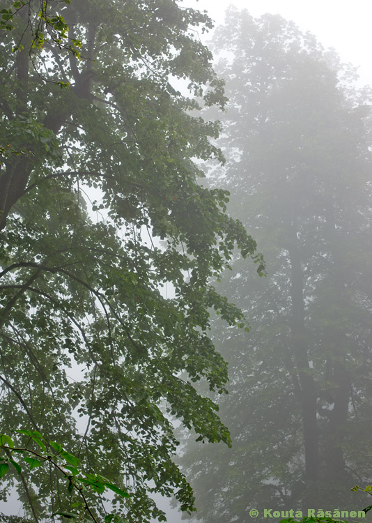
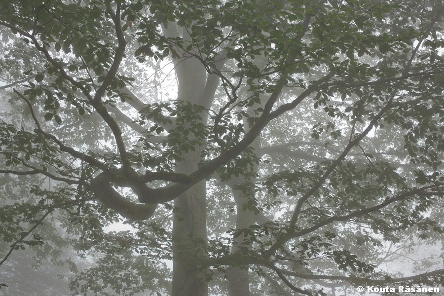
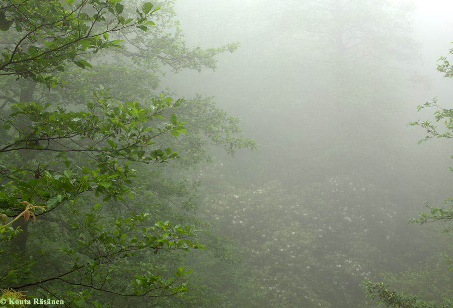
but more abundant on other trees. The upper slopes are shrouded by fog almost daily
4
.

The park has two hiking routes. The shorter one, through
Juglans regia
(Persian walnut) and other plantations, is mostly located outside the park and is not worth hiking for the forest (the trail ends at a waterfall). But the longer one (meant as a two-day trail but possible to hike in one long day) runs at higher elevations through gorgeous
F. orientalis
forests. Overnight stays are allowed in a camping place near the above-mentioned waterfall and in a shelter at the end of the longer trail at 1235 m elevation. The trails begin at Chakvistavi village, which can be reached by taxi from Chakvi (the 15 km trip along a very bad road takes 45 min).
References :
1 Krever, V. et al. (eds.) 2001: Biodiversity of the Caucasus Ecoregion. An Analysis of Biodiversity and Current Threats and Initial Investment Portfolio. WWF.
2
Memiadze, N. et al.
(2013):
 Flora of Mtirala National Park
. International Caucasian Forestry Symposium.
Flora of Mtirala National Park
. International Caucasian Forestry Symposium.
3 Nakhutsrishvili, G. (2013): The Vegetation of Georgia (South Caucasus). Springer.
4 Mtirala National Park administration, pers. comm. (2014)
5 Bobokashvili, Z. & Maghradze, D. (2009): Georgia. In Avanzato, D. (ed.): Following Chestnut Footprints ( Castanea spp.) .
6 Schmidt (2002-7): Bäume und Sträucher Kaukasiens. Mitt. Dtsch. Dendrol. Ges . 87-92.
Official site:
http://apa.gov.ge/en/protected-areas/cattestone/mtiralas-erovnuli-parkis-administracia
Video clip:
http://www.youtube.com/watch?v=FRR4yNY_iz4
-
-
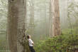
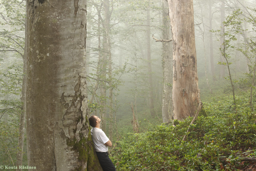
Fagus orientalis (oriental beech) forest. Elev. approx. 800 m.
-
-
Fagus orientalis (oriental beech) forest. Elev. approx. 1000 m.
-

-
Two Tilia dasystyla subsp. caucasica (Caucasian linden) at approx. 1100 m.
-
-
Fagus orientalis (oriental beech) at approx. 1100 m.
-
-
Creek valley at approx. 1100 m. Alnus glutinosa subsp. barbata (black alder, left) and flowering Rhododendron ungernii .
-
-
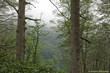
View of the park.

-
-
Fagus orientalis (oriental beech) forest. Also small Castanea sativa (sweet chestnut, left centre). Rhododendron ponticum (pontic rhododendron) understorey.

-

-
Fagus orientalis (oriental beech), girth 536 cm. Rhododendron ponticum (pontic rhododendron) understorey. Elev. approx. 900 m.
-

-
Some canopy tree and understorey (bottom) species at upper elevations.